


Once the laughing-stock of the navigation app market, Apple Maps is now a powerful, reliable travel companion. Apple rebuilt the platform from the ground up, placing the app in league with Google Maps. That said, there's always room for improvement, as demonstrated by its impressive new features set in iOS 14.
There's no doubt iOS 14 will change the way you get around with Maps. Chief among these features is cycling directions, a much-needed upgrade for anyone who relies on two wheels for their commute. Even if you're not a biker, however, you'll find great new features like Guides, speed-trap camera alerts, and more.
- Don't Miss: 200+ New Features & Changes in iOS 14 for iPhone
1. Cycling Routes
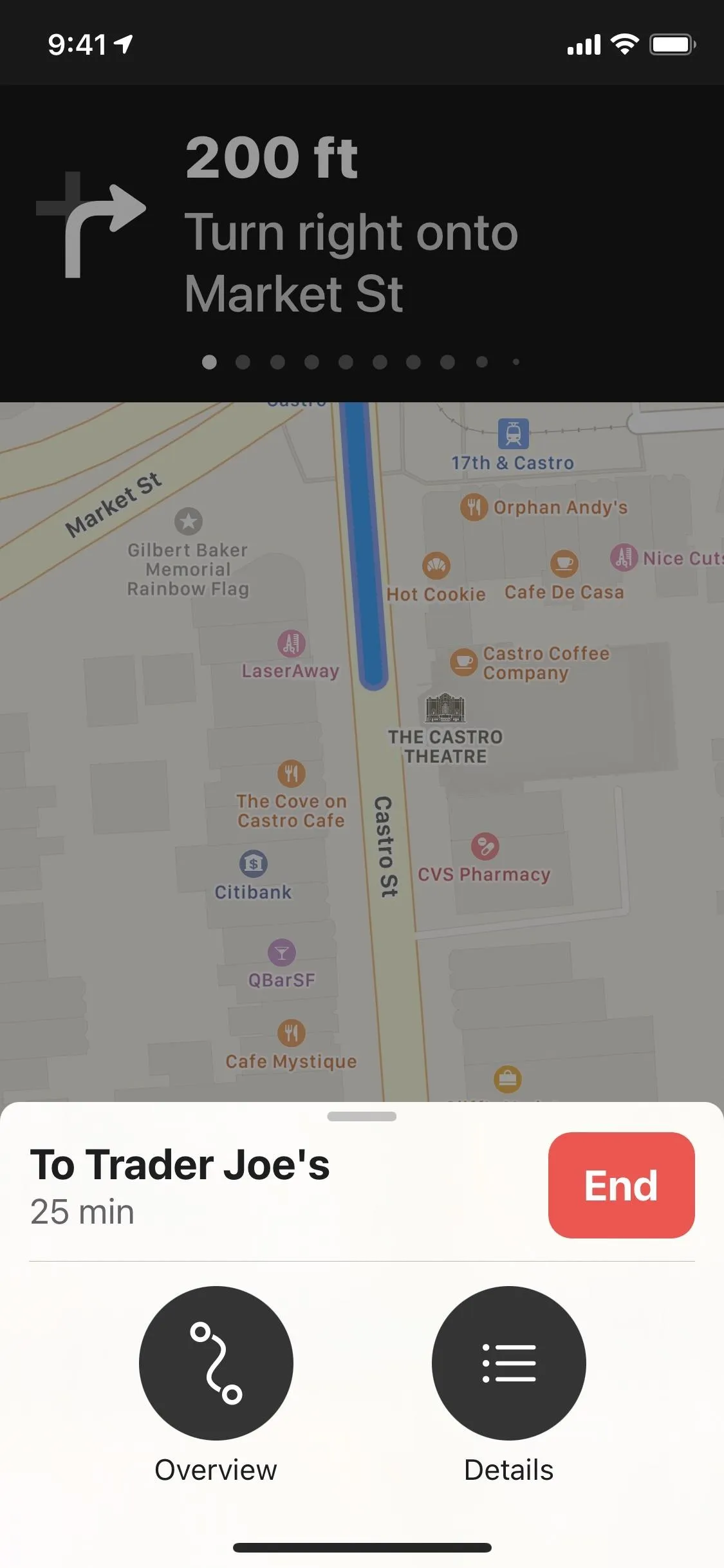
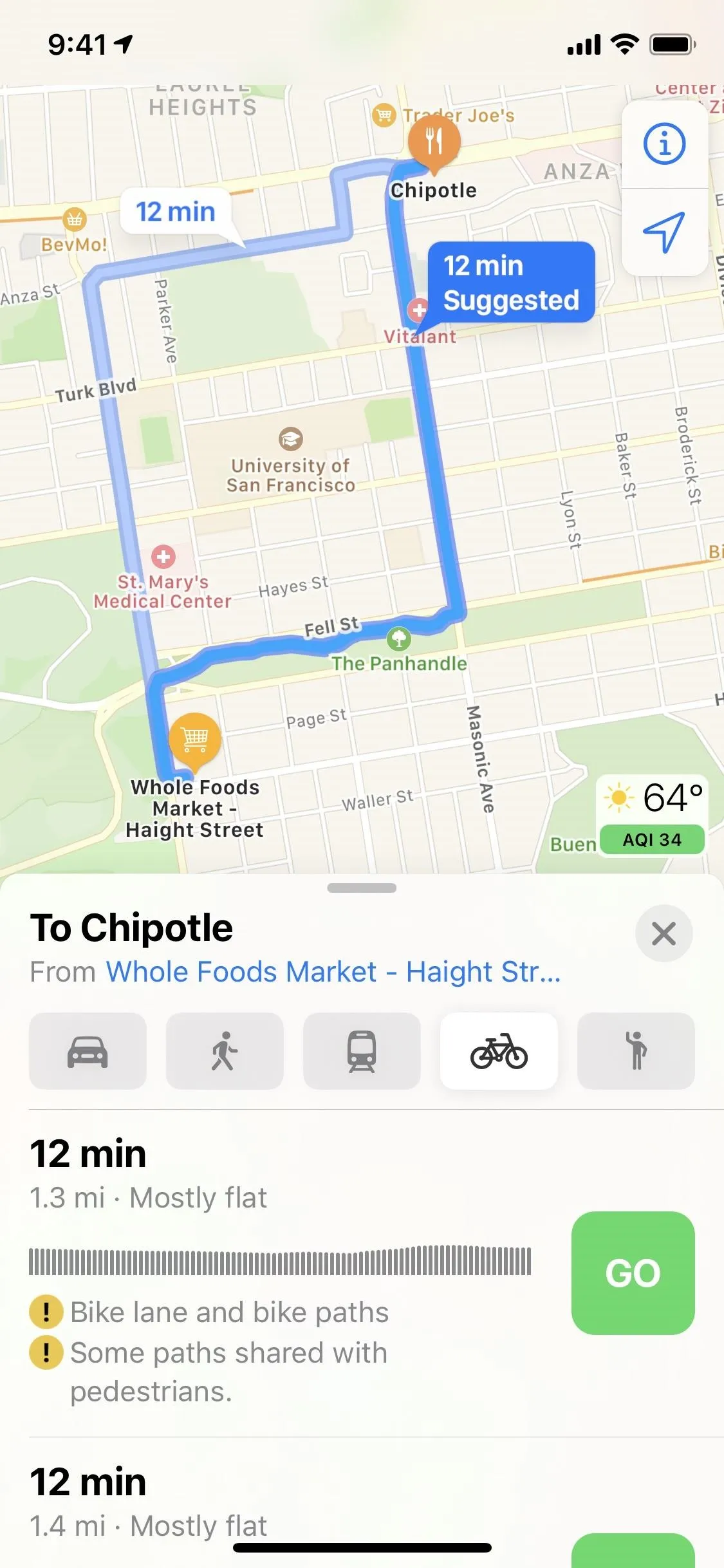
Bikers rejoice! Apple Maps has cycling directions! The new tab joins the traditional driving, walking, transit, and ride-share options. No longer will you need to rely on driving instructions for your biking route, which weren't always safe or ideal.
When you use the new cycling tab, you'll see instructions for bike-friendly streets, but Maps will also send you on bike lanes, bike paths, and side roads. You'll also get a heads-up if you need to get off your bike and walk any part of the route. So there shouldn't be many surprises on your ride.
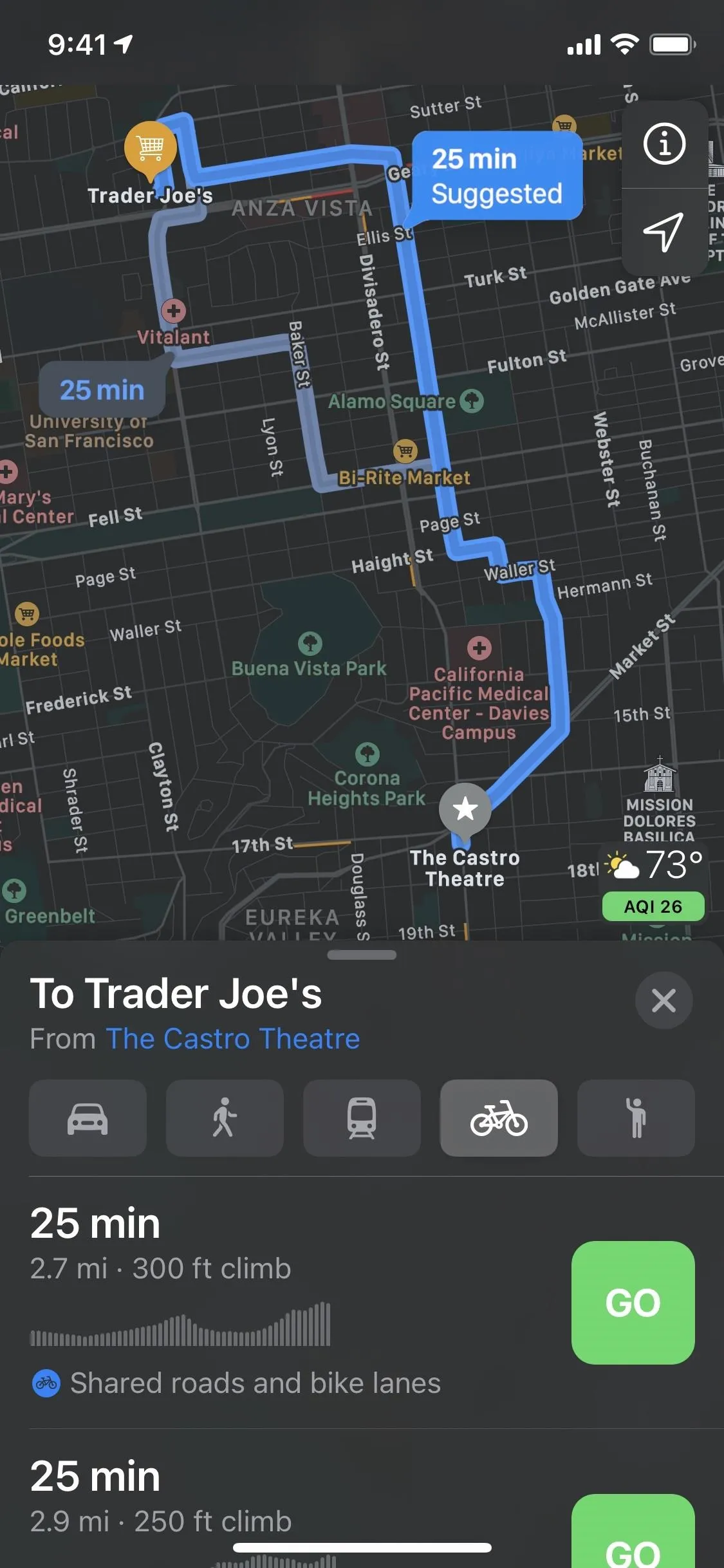
Cycling directions may take some time to reach your area, however. At the onset, the feature only covers Los Angeles, New York City, and the San Francisco Bay Area. Apple seems keen to take its time with Maps these days, but the result is usually quite impressive.
For example, when Apple revealed its massive Maps redesign for the U.S. in June 2019, it took about four months until we saw significant expansion, then another four months until the entire U.S. saw the enhanced maps. We could be looking at a similar timeline for cycling directions.
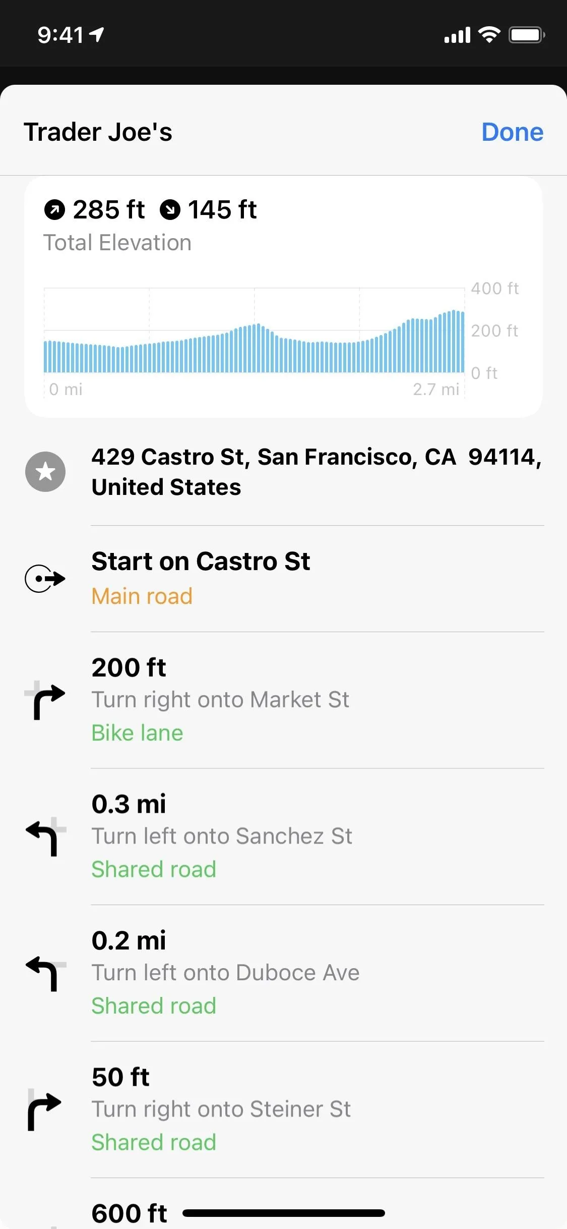
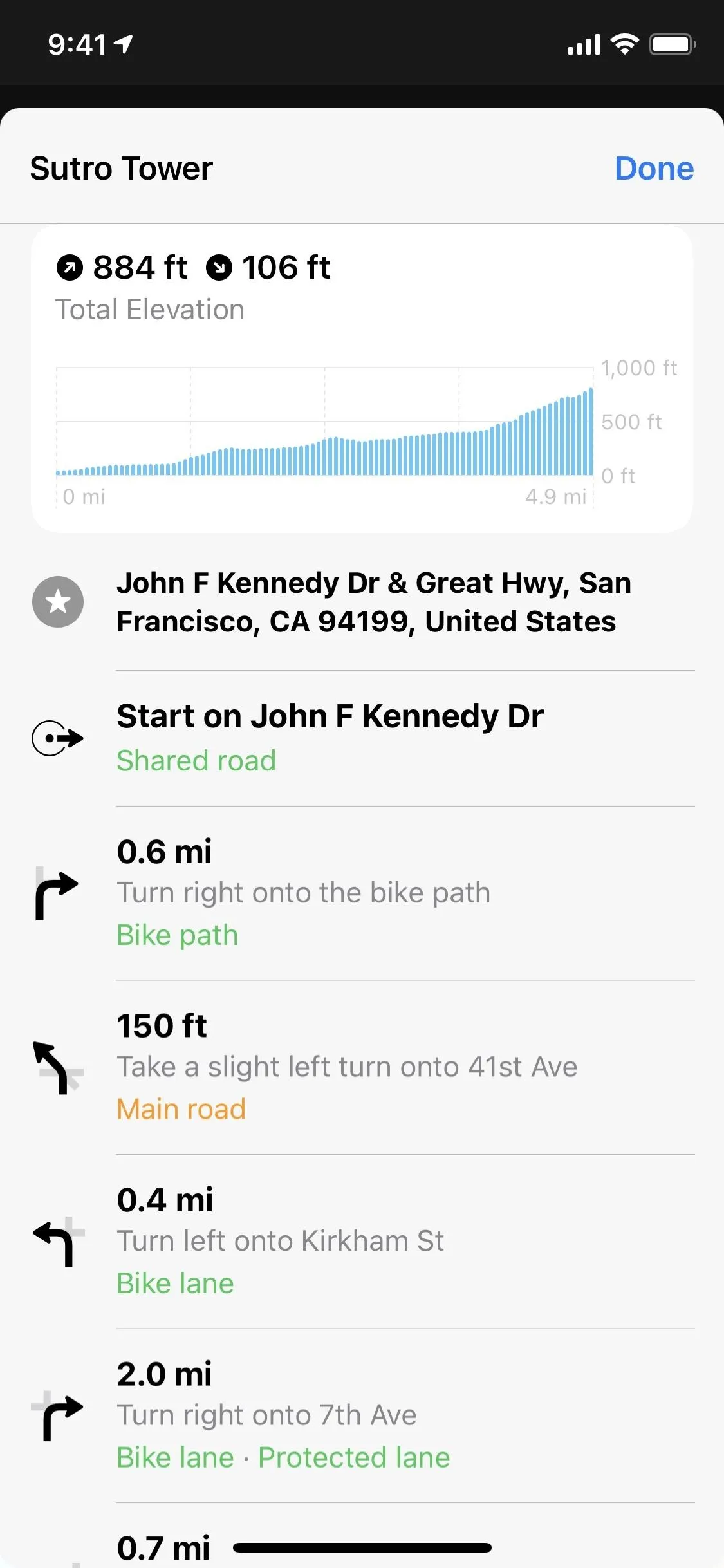
2. Elevations for Cycling Routes
Drivers usually don't worry about the elevation of their ride. Bikers do since they require stamina and endurance at different skill levels depending on the acclivity of the climb. Maps makes it easy by offering detailed graphics and information about the elevation changes of several possible cycling routes.
You'll see a brief description of the route (e.g. gently downhill), how many feet you need to bike uphill, and how many feet you need to coast downhill, among other helpful tips. Maybe we'll also see this for walking directions one day!
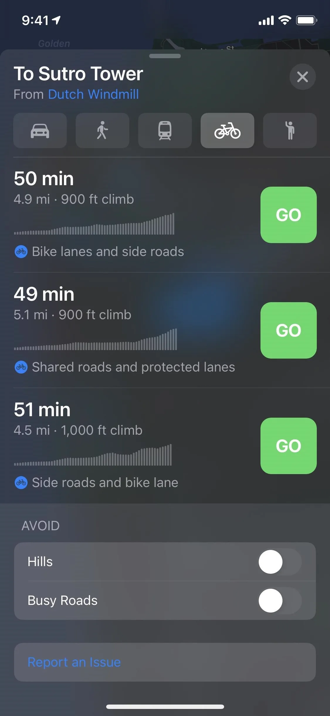
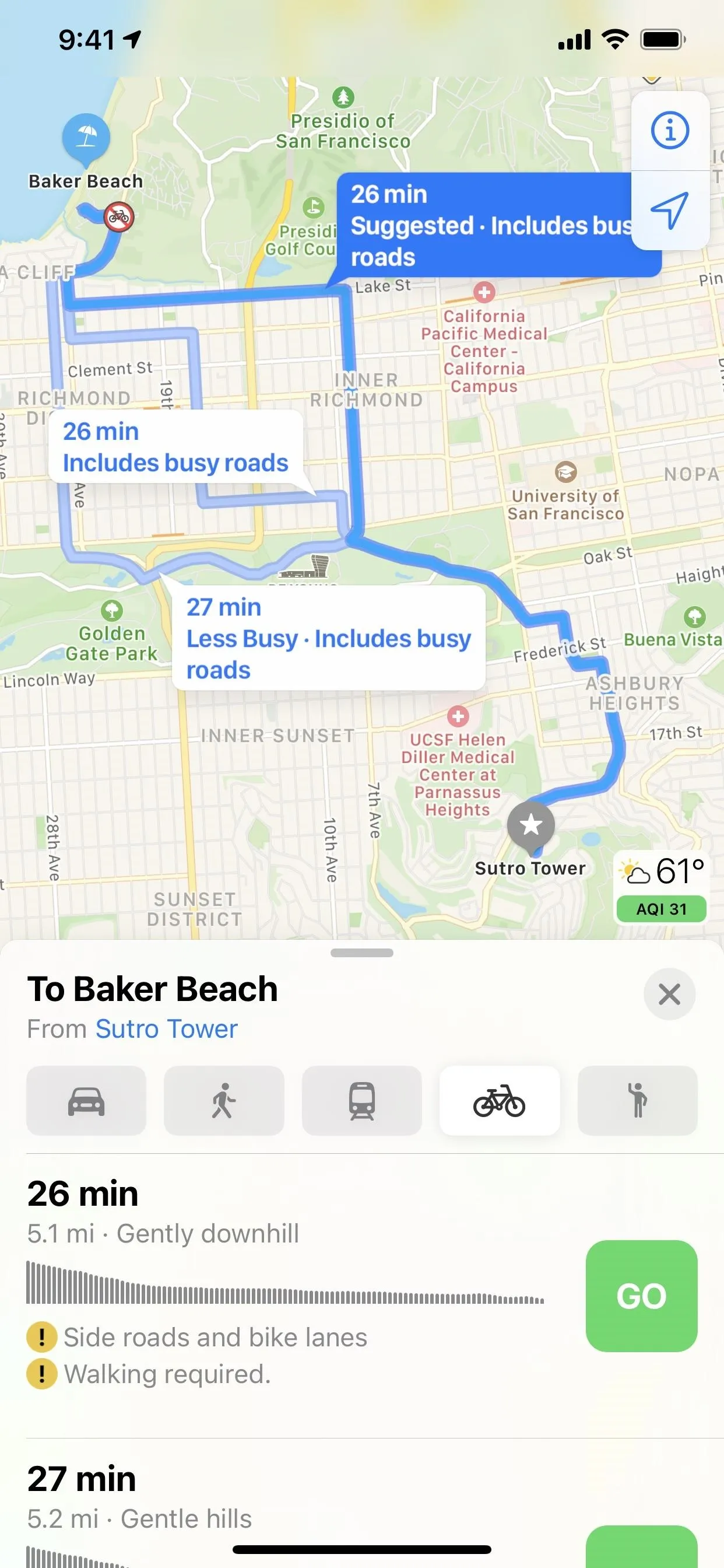
3. Busy Street Warnings for Cycling Routes
Ever wonder how many cars or cyclists you'll run into on your commute? Maps offers that information right away. If your best routes are busy, the app tells you and helps compare alternates that might be better on traffic. Some identifiers you'll see include "includes busy roads" and "less busy." Just know that if there's low to no traffic on a given route, you'll see the same time indicator you usually do.
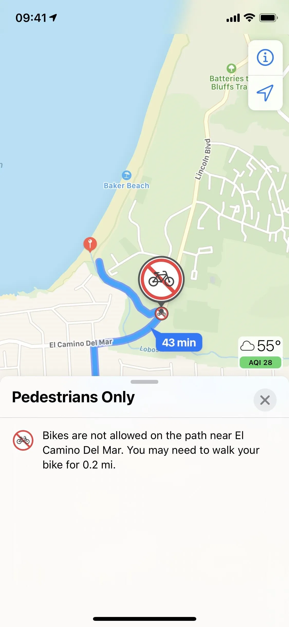
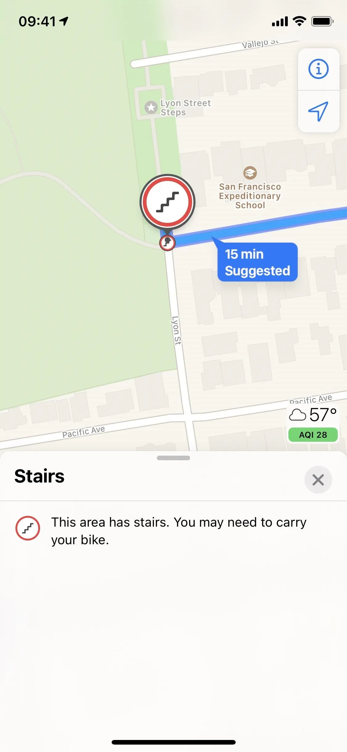
4. Other Warning Labels for Cycling Routes
In addition to the busy indicators for cycling routes, you'll also see icons on the map that let you know where there's a steep incline, where stairs are, or when you need to walk instead of ride. These labels can be seen on the mapped routes as well as in the information for each one in the pull-up window under the elevation gain.
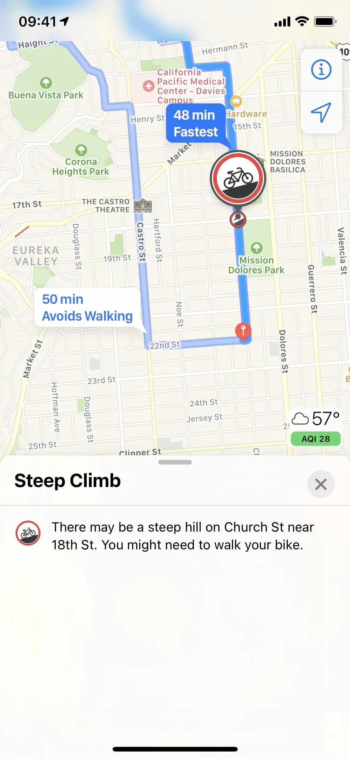
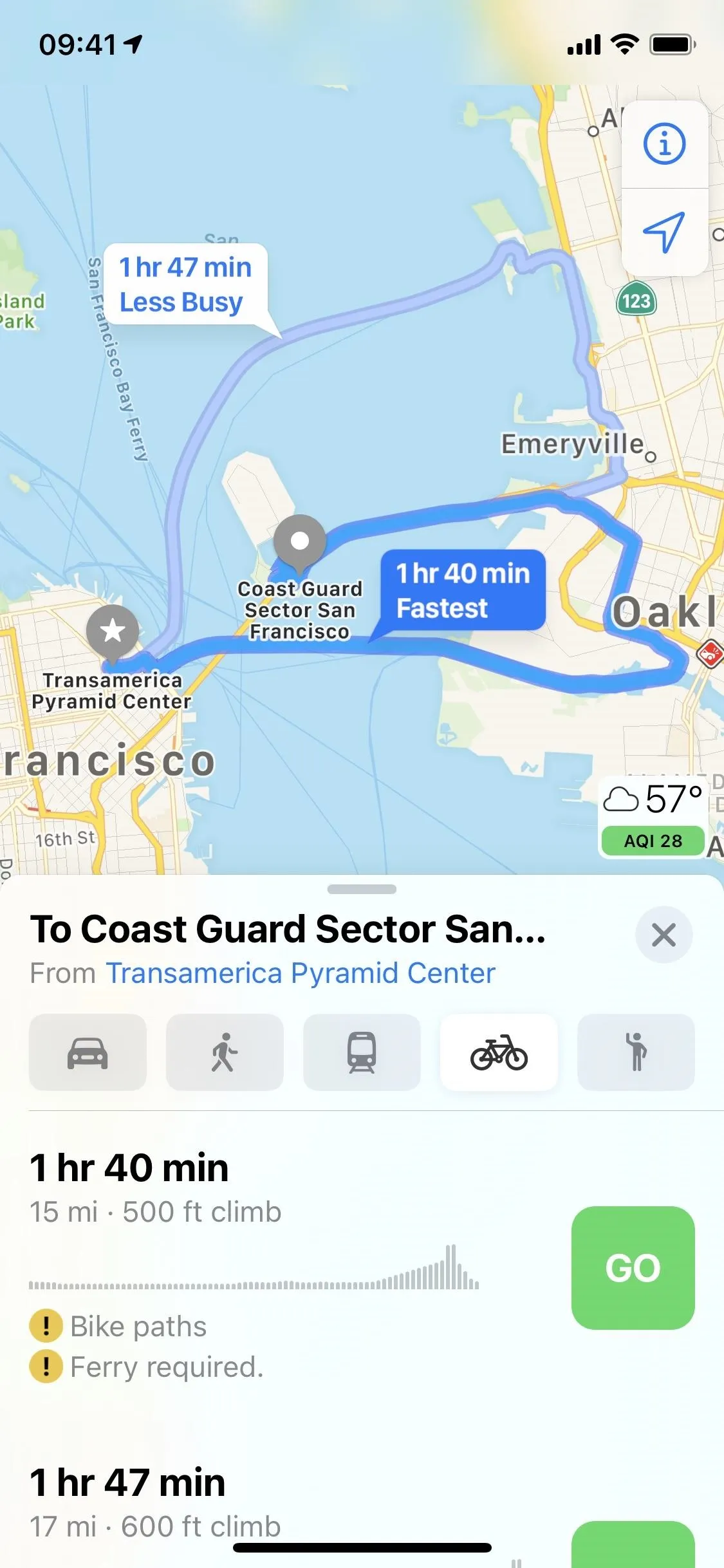
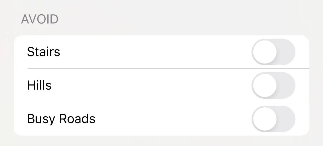
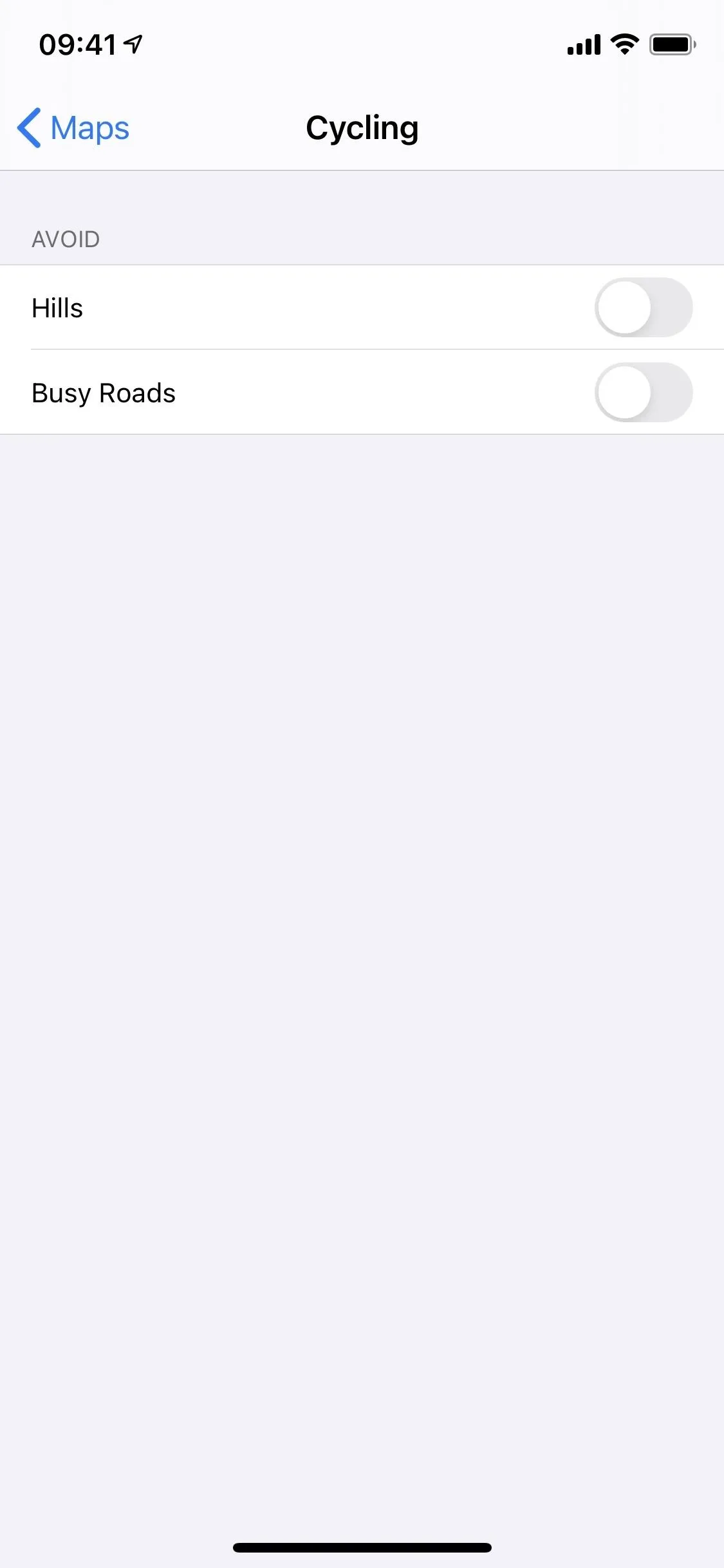
5. Stairs, Hills & Busy Roads Avoidance for Cycling Routes
Imagine a cycling commute that includes only flat roads — what a concept. Maybe your commute is like that, but in many cities, that simply isn't the case. You'll face steep inclines, jam-packed roads, and even staircases to carry your bike up.
The good news is that Maps can attempt to circumvent your trip around any or all of these obstacles. You can choose to avoid stairs, hills, busy roads, or any combination of the three, and Maps will do its best to accommodate. Unfortunately, no guarantees can be made, and these buttons might not always appear, so you may end up having to carry your bike up those stairs after all.
6. Voice Guidance for Cycling Routes with Apple Watch
If you have an Apple Watch, you likely enjoy tracking your biking via the Workout app. With Maps in iOS 14, Apple offers you an exclusive experience. According to the company, "Maps ... offers custom cycling voice guidance and a rich experience on Apple Watch that makes it easy to navigate with a glance." It's nice to see Apple adding a little something extra for those of us who own wearables.
7. City Guides
Looking for a great spot to eat in a new city? How about the best trail to hike on your vacation? Sure, you could hit up Google and sift through "expert" after "expert," or you could simply open Maps in iOS 14.
Apple has partnered with some of the best names in tourism and travel to create a feature called "Guides." It offers data-rich in-app brochures for virtually anything you can think of. For example, you can browse the best pizza shops in San Fran, reading about what makes them great with quick access to their Maps pages. How about the best spots for a hike in a new city? Same concept.
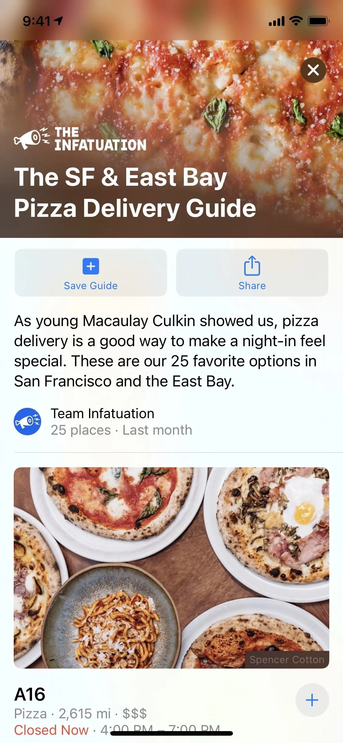
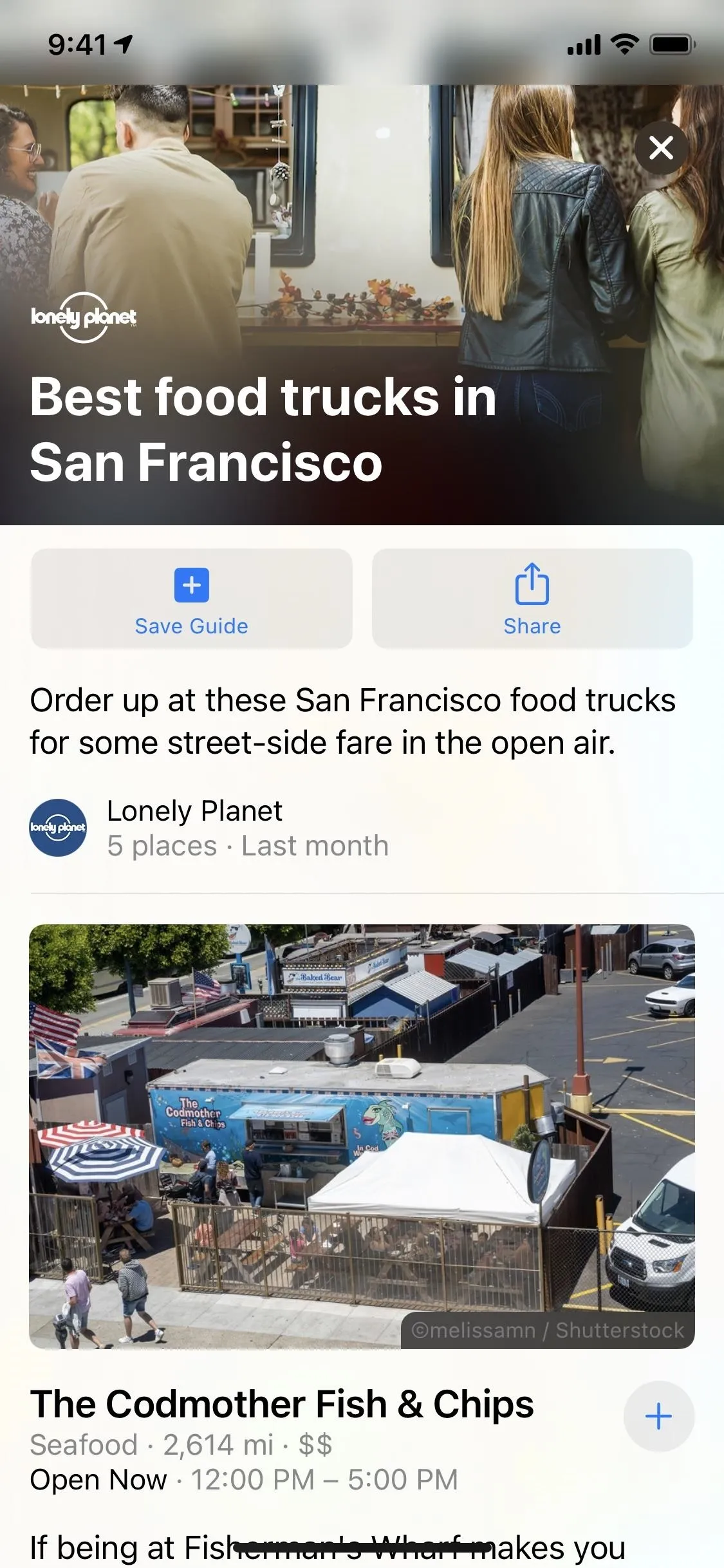
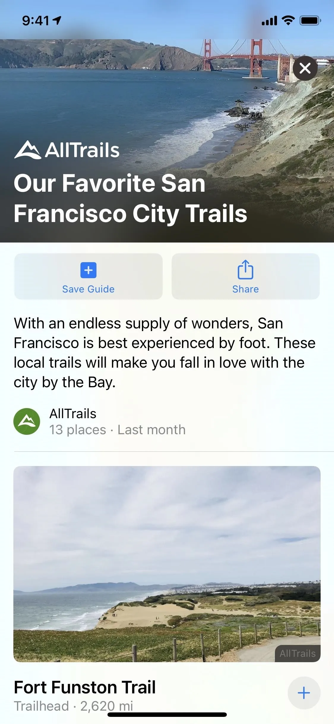
These guides will be continuously updated and can be saved for later viewing. Companies like AllTrails, Louis Vuitton, Zagat, Team Infatuation, and Lonely Planet are already creating Guides for Maps, but we're sure there are many more out there — and many more on the way. You'll only see Guides in San Fransisco, New York, London, and LA currently, but more cities should be coming soon.
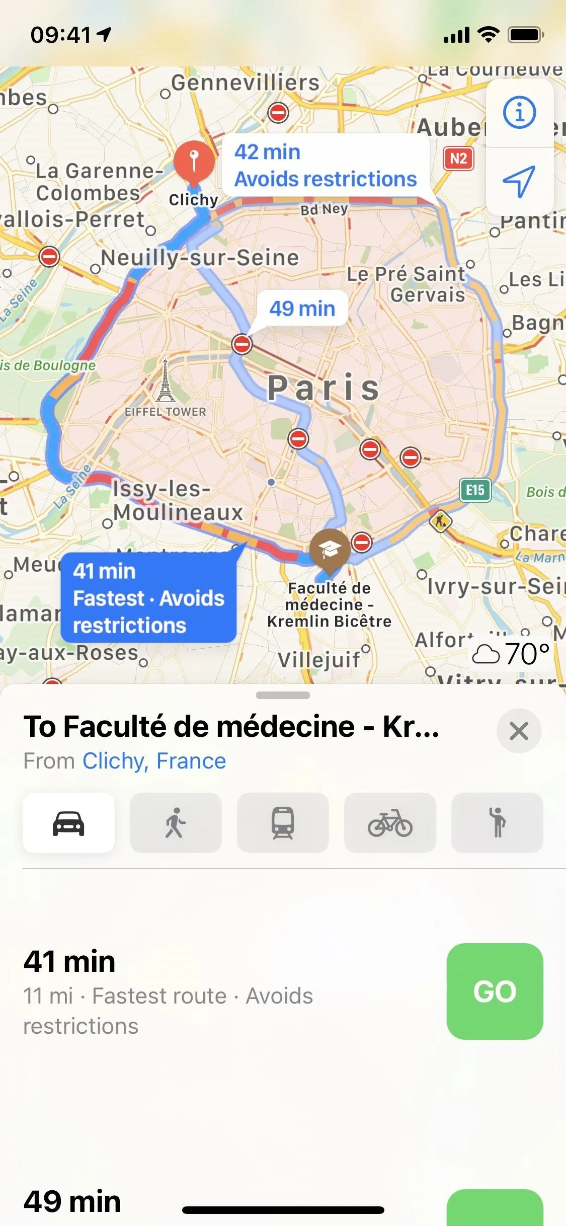
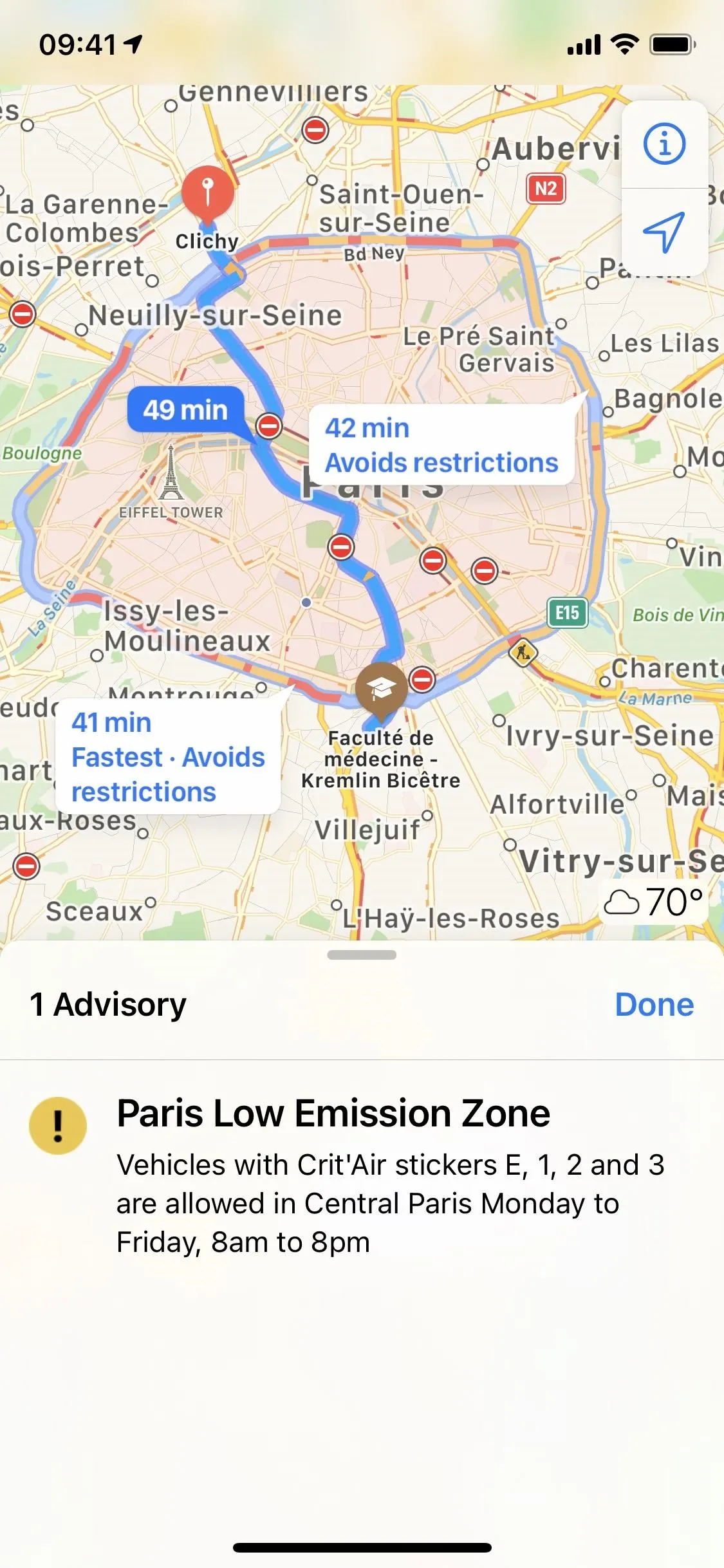
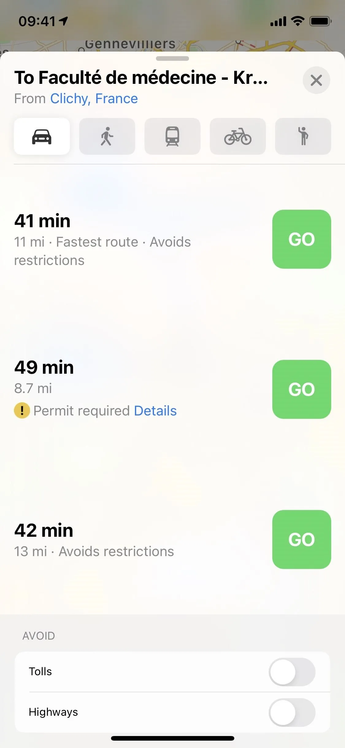
8. Congestion Zone Alerts
City traffic can get bad, real fast. To combat gridlock, some cities have created congestion zones, which charge a fee for drivers to enter. This strategy cuts down on traffic but hurts your wallet if you don't realize where you're driving.
Maps can help you avoid unnecessary spending (as well as additional contributions to traffic) by alerting you to congestion zones near you and routing you around them. London and Paris are famous for their congestion zones, but other cities like New York are also implementing the strategy.
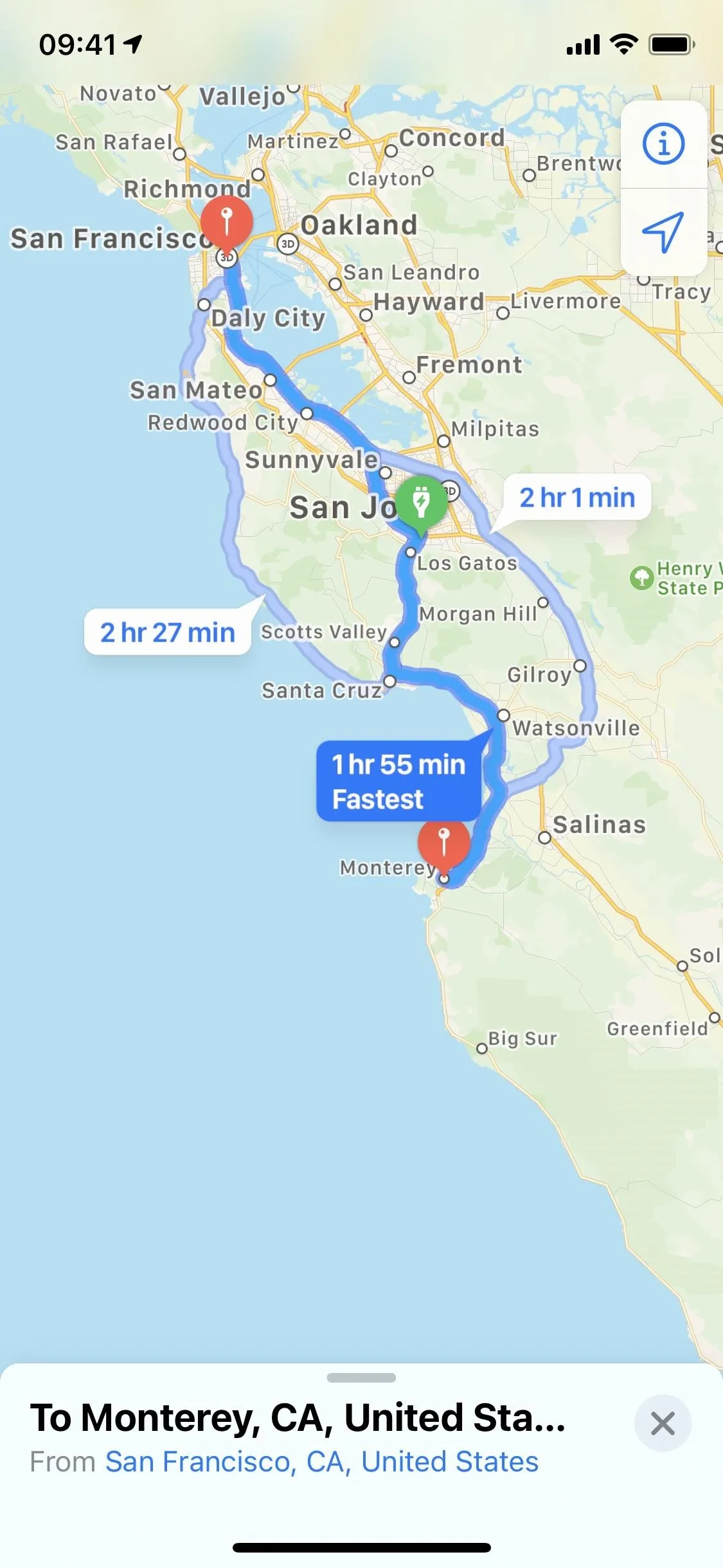
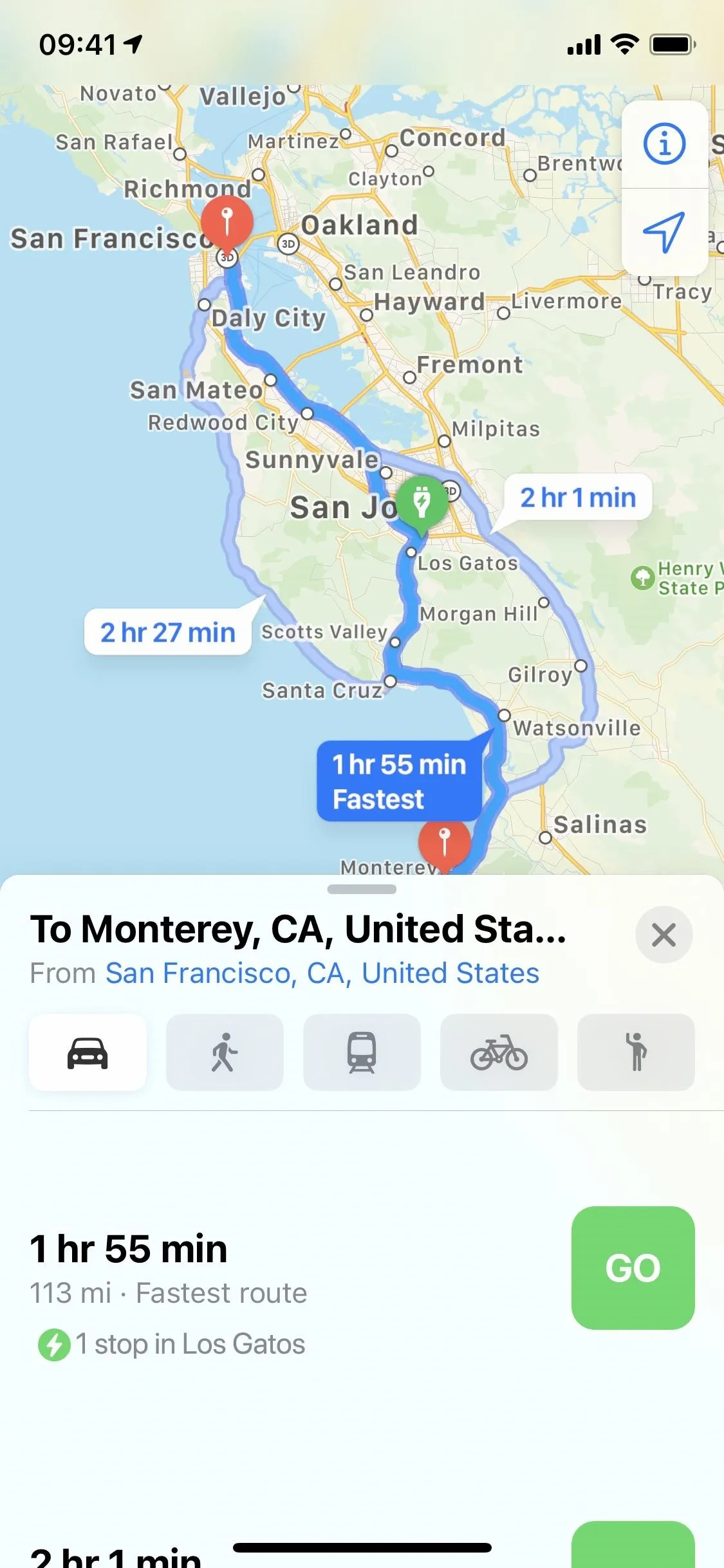
9. Electric Vehicle Routing
Electric vehicles are undoubtedly the way of the future, but that future isn't quite here yet. As such, you'll see far more gas stations along the road than you will EV stations, making a trip in the all-electric machine a bit daunting.
Fret no more, as Maps now sports EV routing! It isn't a generic map, either. The app asks for your car's make and model, so when you next enter a destination, Maps shows you exactly where you should be stopping to top off your electric vehicle. You'll see how long your car will take to charge, which is added to your overall ETA, all while taking into account your car's current battery level.
If you have a BMW or a Ford, you're first on the list — those two companies are the first that Apple is working with, but we expect many more electric automotive makers to be joining as well.
10. More Precise Maps in Dense Urban Areas
Have you ever had trouble using Maps (or any GPS app for that matter) through a dense city? Things might be going great, then all of a sudden, the map thinks you're on a completely different street. Yikes. If this is an unfamiliar city, a faulty nav app is the last thing you want.
However, the issue isn't necessarily with Maps since it can be tricky for GPS signals to be precise in such a dense environment. Instead of relying on GPS for these situations, Apple has enhanced Maps in iOS 14 to take in more accurate location and orientation readings. All in all, unreliable city maps showing where you are and how you're oriented should be a thing of the past.
11. Speed Trap & Red-Light Camera Detection
Nobody likes an unexpected speed trap or red-light camera. If you're sick of paying tickets, Maps is here to help. The app alerts you to incoming speed traps and red-light cameras, so you know to slow down and watch your surroundings. And having these indicators makes sense since the feature forces drivers to slow down on the roads while saving money along the way. It's a total win-win.
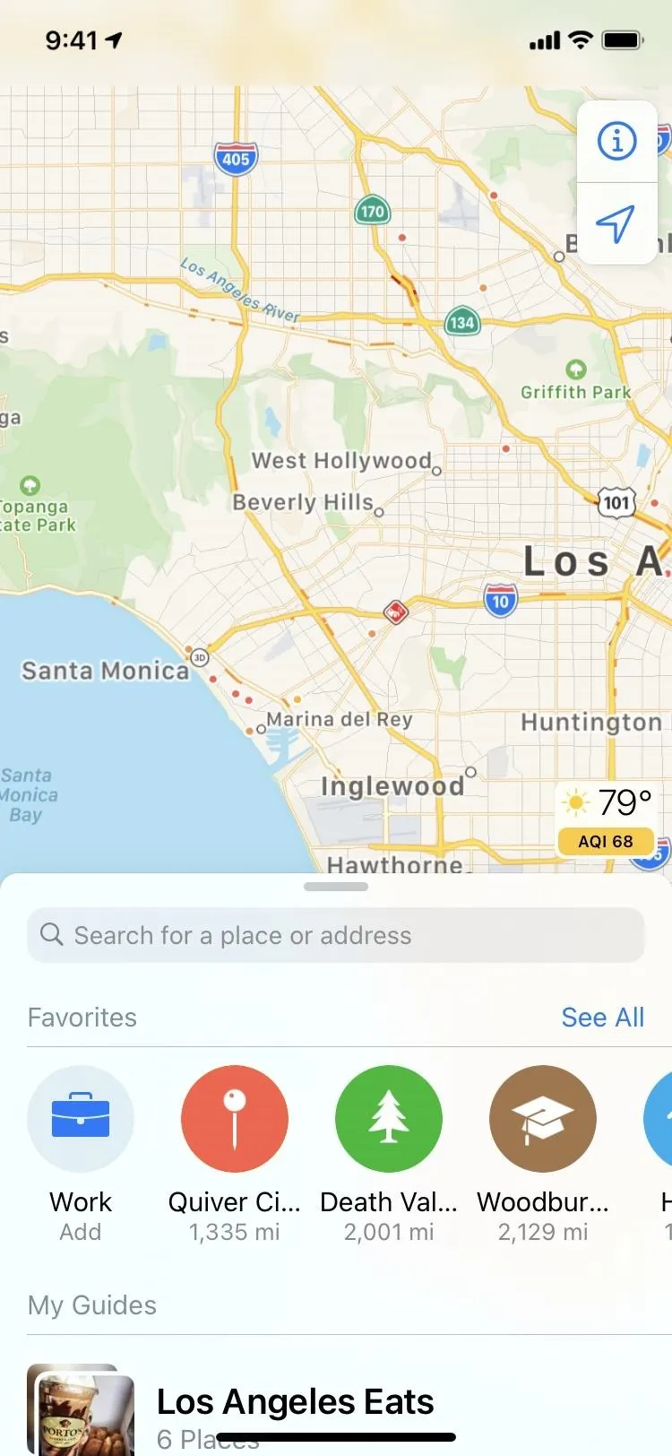
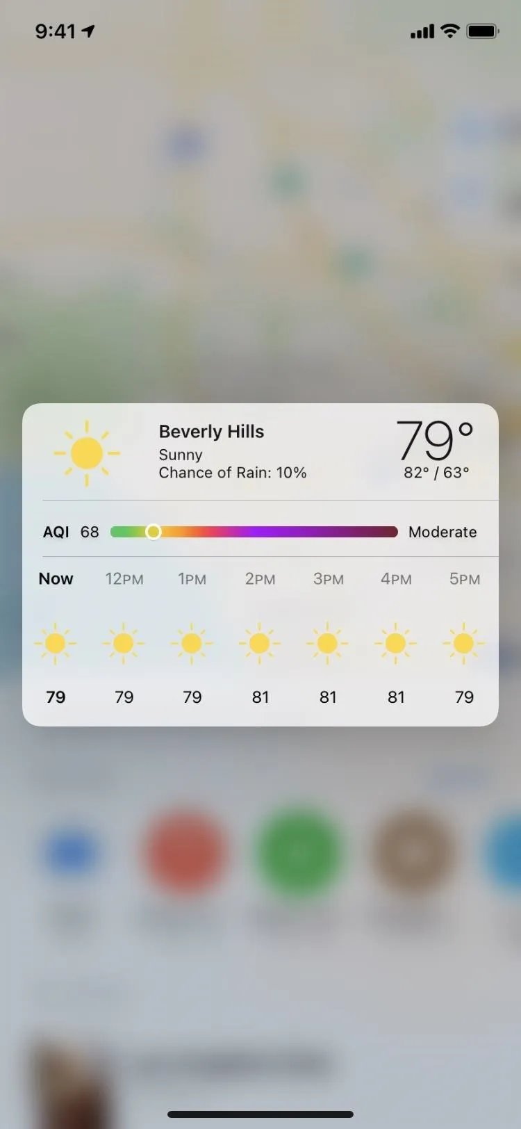
12. Expanded Air Quality Details
We've had the little weather forecast icon on Maps for a while, and the Air Quality Index was added to it in iOS 12.2. The AQI lets you know how much pollution is in the area, but you would only get a color and number here. Long-pressing the icon to expand it only showed more detailed weather information. Now, in iOS 14, you get the AQI in the expanded menu too so you can compare it to other level colors to get a better idea of how good or bad the air is.
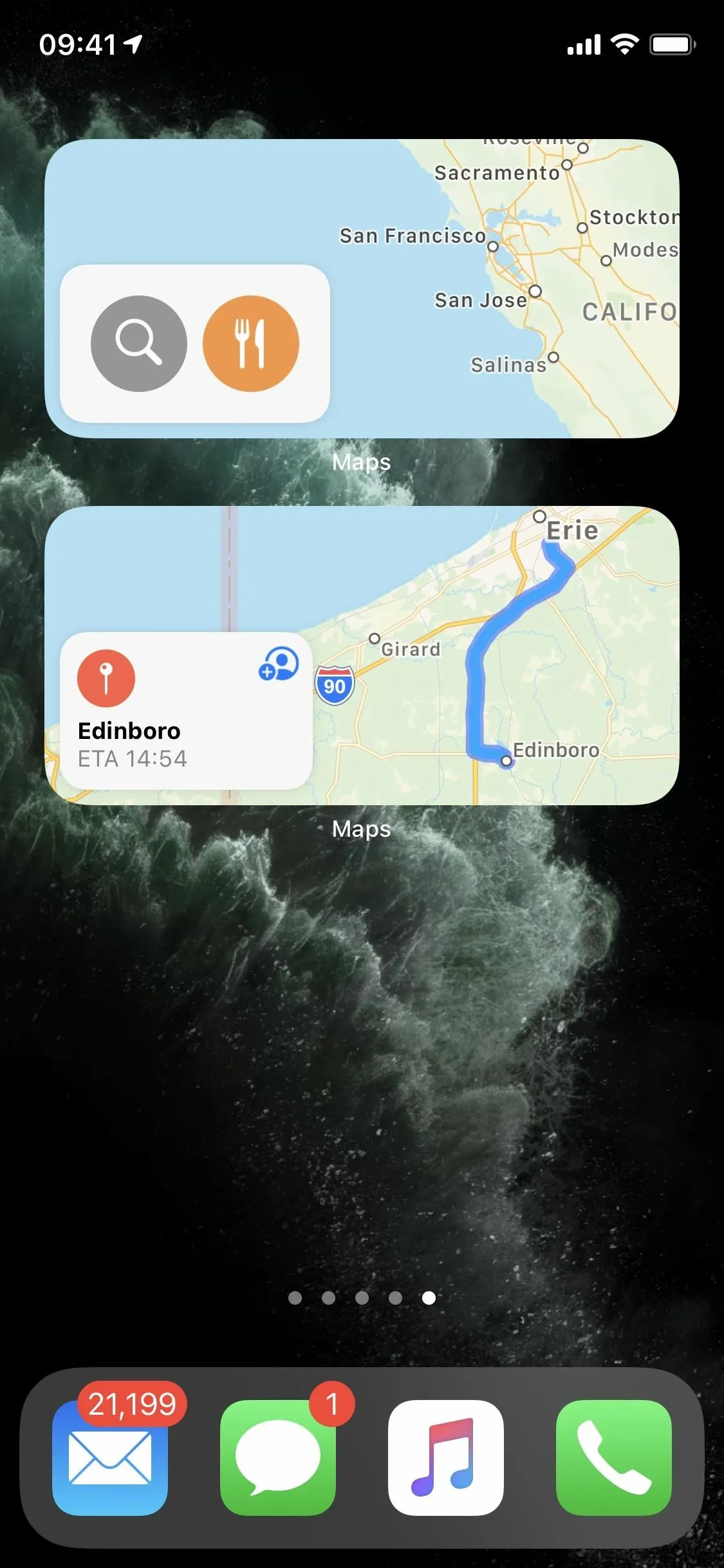
13. New Widgets & Sizes
As part of one of iOS 14's most prominent new features, you can now add one of three widget sizes for Maps to your home screen or Today View. The Maps widget can show you your destination's ETA at a glance, as well as suggest routes based on your travel history and iPhone usage.

14. Reworked Settings Menu
When you pull up Maps in Settings, you'll see Cycling as a preferred type of travel, along with its option under Directions, where you'll find the avoidance toggles (which are also found when looking at routes).
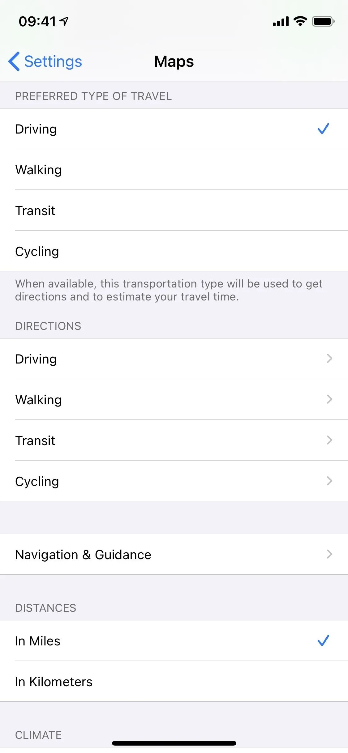
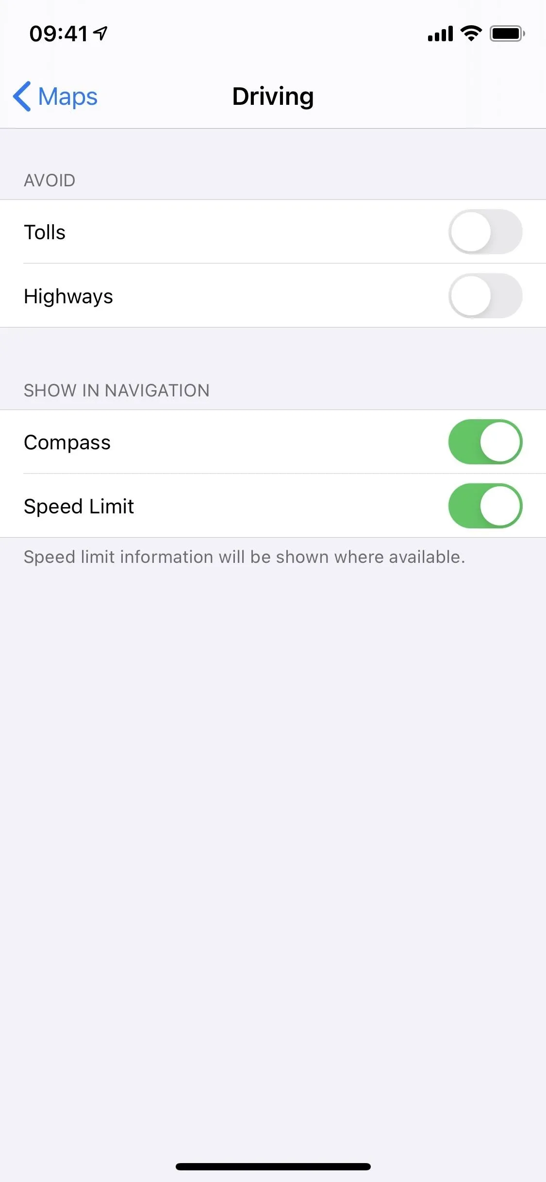
So what else is new here? The navigation aspect was pulled from "Driving & Navigation" into its own "Navigation & Guidance." That's where you'll find the voice volume, the option to pause spoken audio, and share ETA preferences. There's also a new option here (see below). The switches to avoid tolls and highways, as well as showing the compass and speed limit, are now found in the "Driving" directions preferences.
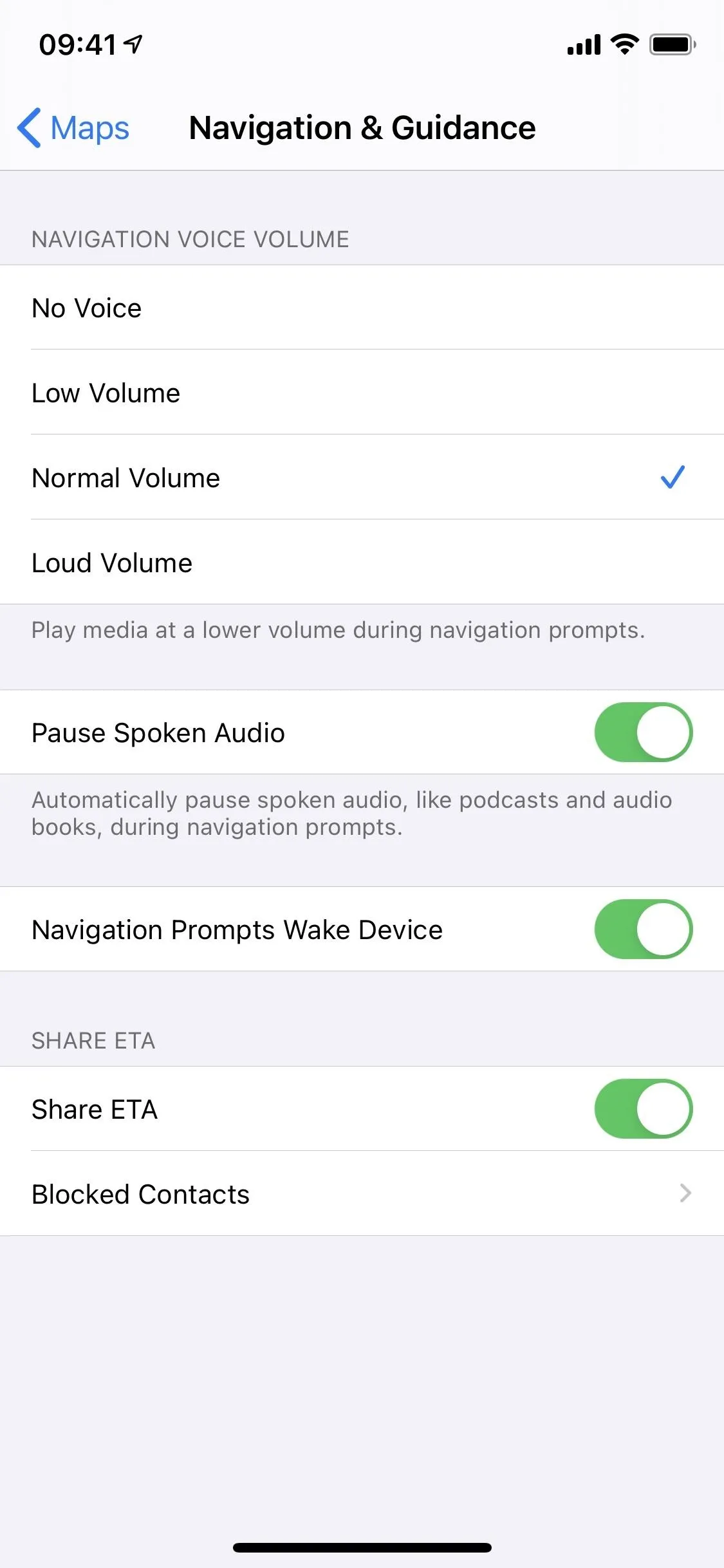
15. Navigation Prompts Wake Device
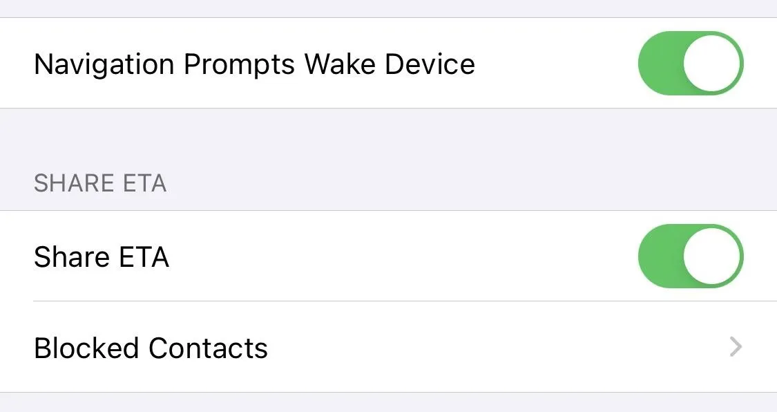
If you didn't notice above; there's a new switch called "Navigation Prompts Wake Device." It's on automatically, but you can toggle it off if you don't want prompts to make your screen go from black to the navigation view.
16. More Countries Get Enhanced Maps
Apple is a U.S. company, so it makes sense that its overhauled Maps app started here first. The good news for other countries, however, is that the new UI is expanding. Canada, Ireland, and the UK are the lucky starters, but we expect Apple to continue growing as quickly as possible.
Cover photo by Jake Peterson/Gadget Hacks; screenshots by Jake Peterson and Justin Meyers/Gadget Hacks


Comments
Be the first, drop a comment!