Header Banner
gadgethacks.mark.png
Gadget Hacks Shop Apple Guides Android Guides iPhone Guides Mac Guides Pixel Guides Samsung Guides Tweaks & Hacks Privacy & Security Productivity Hacks Movies & TV Smartphone Gaming Music & Audio Travel Tips Videography Tips Chat Apps

How Your Apple Watch Can Help You Find Your Parked Car

May 22, 2015 11:34 PM
Dec 20, 2018 04:09 PM
Smartwatch displaying a blue dot on the screen, worn on a wrist.

Everyone's forgotten where they parked their car at least once. Either you forget to take note of the section you parked in, or maybe it's more of a Dude, Where's My Car? type of situation. Either way, you're left to circle the same street or parking structure, over and over, with nothing but exhaustion and frustration to show for it.

As location-pinning apps and options for your smartphone became more prevalent, losing your car started to become a thing of the past. Going a step further now, Apple has a built-in feature in their Maps app on the Apple Watch that allows for location pinning, making it easier than ever to find your missing car, boat, hiking trail, or whatever else you tend to misplace, lose, or forget.

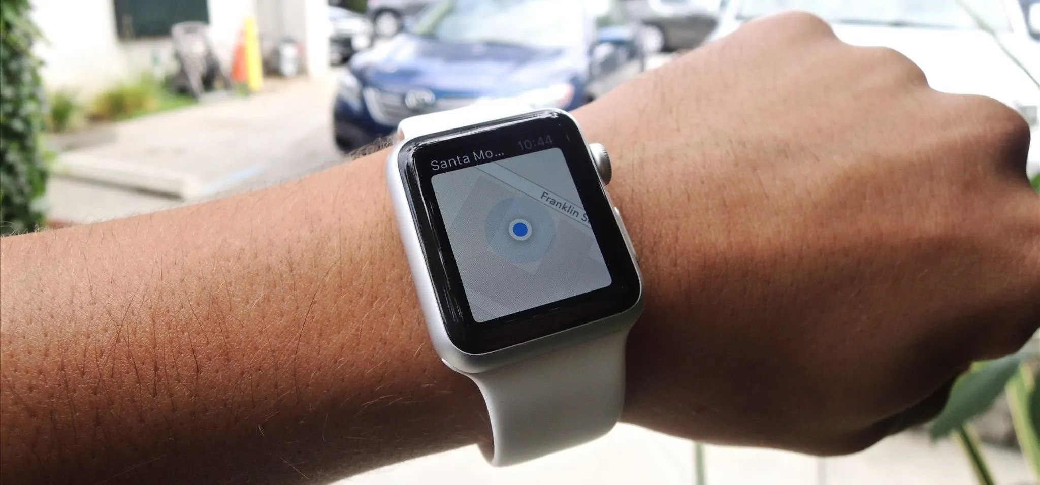
On your Apple Watch, open Maps and wait until the blue dot is directly at your current location (if it isn't, tap on the blue arrow button at the bottom-left). Now tap on the blue dot, then scroll down and tap on "Mark My Location" to drop a purple pin of your current location on the map.

Map showing location in Santa Monica with a focus on S Centinela Ave and Olympic Blvd.
Map interface showing location with the option to "Mark My Location."
Map showing location in Santa Monica with a focus on S Centinela Ave and Olympic Blvd.
Map interface showing location with the option to "Mark My Location."

From there, run errands, get lunch, and go about your day. When you're finished, bring up the map and tap on the purple pin to bring up options for directions for you to get back—either by walking or driving—along with the ETA.

Map showing locations in Santa Monica, California, including Commodore Cafe and New Road School.
Navigation directions for walking and driving, with estimated times.
Map showing locations in Santa Monica, California, including Commodore Cafe and New Road School.
Navigation directions for walking and driving, with estimated times.

When you're ready to go back, hit "Start" and Maps will give you step-by-step directions to get back to your car (or whatever you can't locate).

Navigation map with route highlighted and estimated time of arrival.
Navigation alert for Berkeley Street with distance of 20 feet.
Navigation map with route highlighted and estimated time of arrival.
Navigation alert for Berkeley Street with distance of 20 feet.

Follow Apple Hacks on Facebook and Twitter, or Gadget Hacks over on Facebook, Google+, and Twitter, for more Apple news, apps, and tips.

The next big software update for iPhone is coming sometime in April and will include a Food section in Apple News+, an easy-to-miss new Ambient Music app, Priority Notifications thanks to Apple Intelligence, and updates to apps like Mail, Photos, Podcasts, and Safari. See what else is coming to your iPhone with the iOS 18.4 update.

Related Articles

Comments

No Comments Exist

Be the first, drop a comment!